
$4000
Selling. New
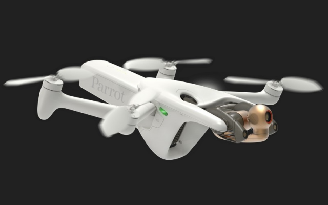
Parrot ANAFI Ai Drone
Quadcopter Parrot
Description
4G: Internet connectivity
Connected without range limit
Flies Beyond Visual Line Of Sight
Worldwide compatibility
48 MP Camera
4K 60 fps: Smooth video
HDR10: Realistic colors
14 EV: Dynamic range
6x zoom: 1 cm details at 75 m (240 ft)
Autonomous Photogrammetry
Shoots 48 MP at 1 fps
Survey grade accuracy: 0.46 cm/px GSD at 30 m (100 ft)
Embedded PIX4D flight planning
4G transfer to PIX4Dcloud
Cybersecurity by Design
No data shared by default
Strong authentication for 4G
FIPS140-2 compliant and CC EAL5+ certified Secure Elements
A Unique Robotic Platform
Software Development Kit with onboard coding capabilities
Full open-source App
The largest Partner Ecosystem for Drones
Parrot believes that drones are useful for everyday business.
They must be easy to use and adaptable to complex missions.
COMPATIBLE THIRD-PARTY SOFTWARE SUITE
PIX4Dscan, PIX4Dinspect, PIX4Dcloud, PIX4Dreact, PIX4Dsurvey
APPLICATIONS
Inspection: buildings, infrastructures, telecom towers, wind turbines, solar panels, pipelines, refineries. Photogrammetry: mapping, surveying, 3D modeling, orthophotography.
Construction monitoring, automated surveillance, real estate, insurance, video creation.
Original source:
https://ts2.shop/en/drones/10976-parrot-anafi-ai-drone-3520410049378.html
Information
Publication date
2023-04-23
Section
Drones
Category
Quadcopters
Manufacturer
Views
386
Favorites
0